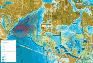
 From David Maidment, University of Texas – For nearly three decades, we at the University of Texas (UT) have been working with Esri to support the intersection of GIS and water resources, particularly in the areas of hydrology and flood mapping. Recent technological advances—and their proven value in the face of Hurricane Harvey—make this a good point in time to reflect on how we got here, highlight recent developments, and share future initiatives. (more)
-
- Translation Notice