From The Public Policy Institute
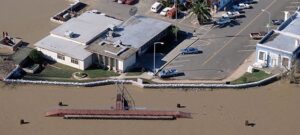
BRETT SANDERS: We basically rely on Federal Emergency Management Agency (FEMA) maps to evaluate flood risk across the state. We make a lot of decisions on the risk to property and people based on whether they live inside or outside of the high flood risk zones those maps show. FEMA maps are fairly cryptic about flood hazard, and they’re not designed to help the average person understand their exposure to floods or what the impacts might be. This approach does a poor job of preparing communities to be more resilient to flooding. (more)